© www.white-coppice.co.uk 2022

Yarrow Reservoir
Set in miniature Lake District and beautiful it is too
Yarrow Reservoir....
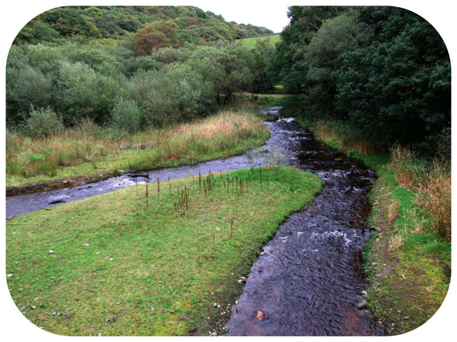
...is the newest and deepest of the eight reservoirs with a surface area of 65 acres and a perimeter of 1.6 miles. There are two embankments, namely Turner’s- 850yds Yarrow- 583yds It was designed by the Borough Engineer of Liverpool Thomas Duncan, and was begun in 1867. Shortly after construction started Duncan died and a Joseph Jackson then oversaw the building of the reservoir until its completion in 1875 and filled in 1877. The highest embankment, Turner’s, stands 103 ft above the original ground level. It contains 839 million gallons ( the third greatest of all eight reservoirs in the scheme. Yarrow’s intake is mostly from The River Yarrow and Limestone Brook, which converge at Meeting of the Waters near the new Alance Bridge. There is one other intake which has a constructed inflow and that is near the ruins of Anderton’s on the east bank. Yarrow’s outflow is through a tunnel by the Yarrow embankment and enters the Anglezarke reservoir under the bridge at the northern end of Knowsley Lane just under a 100 ft below Footpaths It is possible to walk round Yarrow Reservoir. To the north, the country lane provides the route, then on the east side a path leaves Hodge Brow and follows the line of the reservoir. It will take you down to Dean Wood House. Continuing south you meet a lane and then turn north where you will ee the 103 ft embankment that is called Turner’s The path will lead you back to Parson’s Bullough Lane Below The Surface The summer of 2013 was a very dry and pleasant summer, so Yarrow, along with Anglezarke and Rivington reservoirs were lower than they had been for many years. It was Yarrow that provided me with the find that most interested me. For it was there that I discovered the hamlet of Alance, the present bridge of that name replaced an older one a few hundred yards downstream of the present one. At the south end of Yarrow was a farm by the name of Turners, although not revealed at the time of writing there is a chance it may yet be revealed. Its driveway is the track that slopes down to the overflow into Anglezarke. And its gateposts are still standing today, to the left of the bridge over the overflow, which cut straight through the farm track when it was built In 1877 the reservoir was filled and the hamlet of Alance, the original Alance Bridge, and Turner’s Farm all disappeared below the surface.